ABOVE: The Eyre Mountains and upper reaches of The Mataura River caught in the glow as light breaks through heavy clouds, seen from the Garston end of the Nevis Road.
Spring in Queenstown and the Southern Lakes, means never knowing what weather is going to be thrown at us. Luckily, with so many mountain ranges and valleys with their own micro climates, there is always somewhere great for our Remarkable Imagery Photography tours to go to shoot landscapes. Lately w’eve been heading out to The Nevis, a high alpine plain dissected by a wild river. This is my favourite place in the South Island, a pristine wilderness, where the only sound is the wind in the golden tussock grass. It’s a place that celebrates solitude, where you can be alone with nature, feeling as though you were the only person in the world.
People are drawn to Queenstown by images of distant mountains viewed across an expansive emerald lake, cool, dark forests and sparkling streams. The Nevis is spectacular in another way. It’s the “roof” of the landscape; wild and lonely; treeless; graphic, intersecting patterns of valleys clothed in golden waving grass. It looks dry, but water is everywhere, rivulets running into creeks, creeks joining into streams adding to the crashing waters of the Nevis River.
The river rises in the Slate range near Garston and flows north for 80 kilometres before descending rapidly to join the mighty Kawarau. Getting here is a steep winding climb. When we enter from Bannockburn we gain spectacular views of Cromwell, Lake Dunstan and the Lindis Valley to the north, the Old Man Range to the east and the Remarkables to the west. Coming up from Garston, we look down over the winding Mataura River Valley, the green plains of Southland and the wild Eyre Mountains to the West.
This the kind of place that is made more dramatic by weather in all it’s moods. I’ve been here when it is a white wilderness when wreathed in mist and cloud, in blizzard and clear cold frost. The light changes with the weather conditions, always beautiful often amazing.
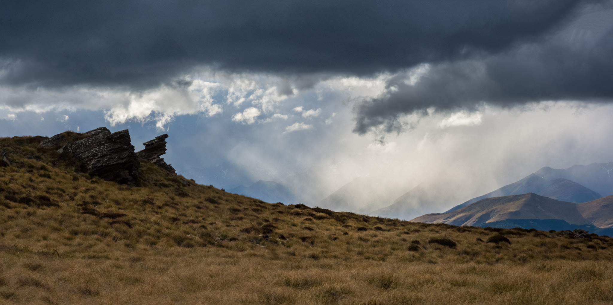
ABOVE: Rock tors, like castles, walls or sculptures created by giant hands, dot the upper Nevis.
Just this week we left Queenstown under brooding grey skies with rain threatening, and drove down Lake Wakatipu past Kingston to Garston where the Nevis Road climbs above cultivated farmland, through sheep country, higher and higher to where only tussock and the alpine spaniards grow. Looking down, the distant Eyre Mountains, the powerful range the locals call Bacurochi and the snaking Mataura River glowed as light broke through roiling clouds.
We went further, switching back and forth to gain height, finally rounding a comer to find ourselves in this high, silent and wild landscape of rocky outcrops and bare hills folding into each other. Further in we crossed streams, that flowed into each other until we were crossing creeks and then the Nevis River. The road continues for 80km to Bannockburn in the north, but we turned to retrace our steps.
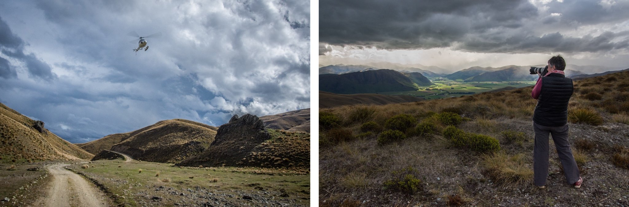
ABOVE LEFT: Tourists viewing the the Nevis Valley the easy way. RIGHT: Shooting the view of the Mataura Valley.
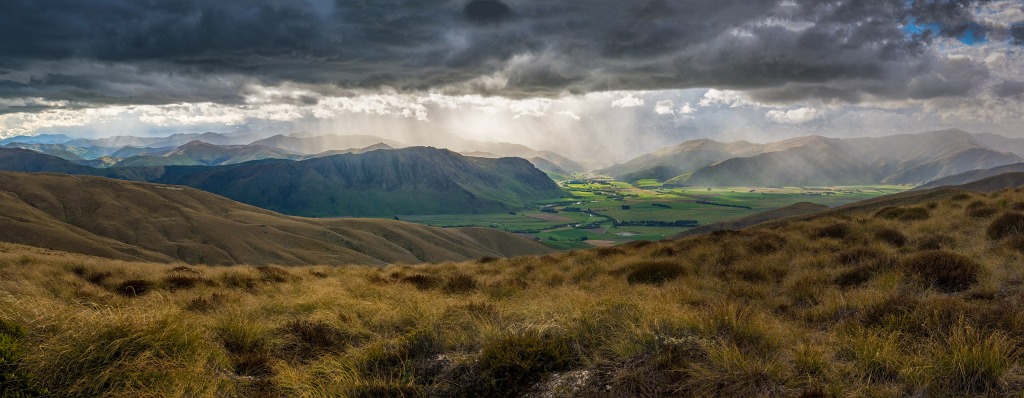
By now, clouds below and far away were beginning to open, letting through the glow of the afternoon. As we got to the point where our descent began again, the site was magical. A whole valley below, glowing iridescent green, golden rays breaking through clouds, illuminating layers of mountain ranges into the distance.

ABOVE: The Eyre Mountains and upper reaches of The Mataura River caught in the glow as light breaks through heavy clouds, seen from the Garston end of the Nevis Road.
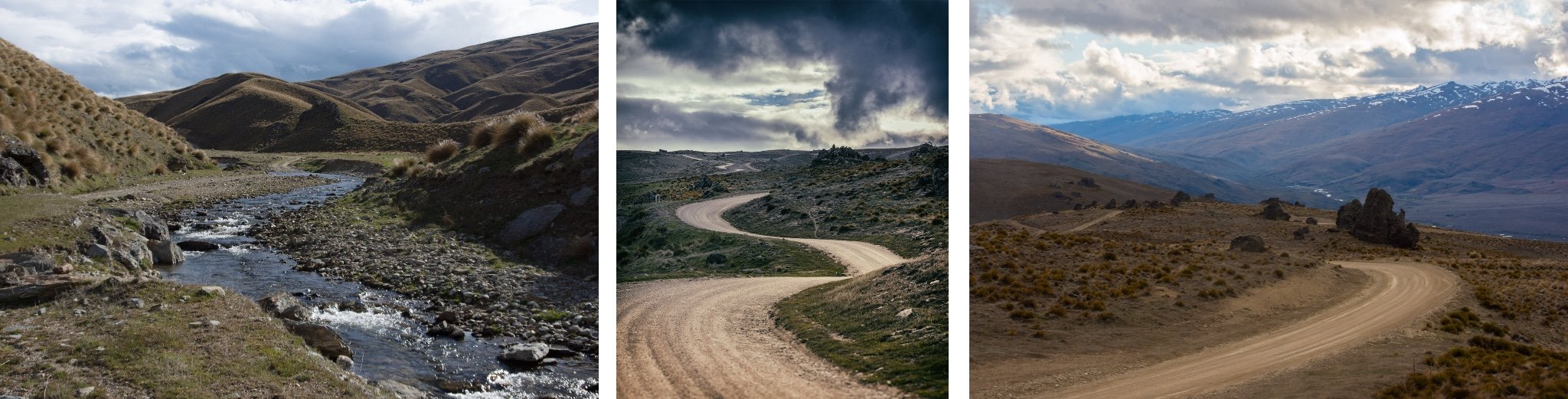
MIDDLE ROW: One of many river crossings on the upper Nevis River; The road winding up to Duffer’s Saddle at the northern end of the Nevis; Massive tors at Duffer’s Saddle where the road heads down into the Nevis Valley.
BELOW: View from Harris Saddle, the highest point at the northern end of Nevis Road. Cromwell and Lake Dunstan is below, with a magical “rain glow” over the Lindis Valley